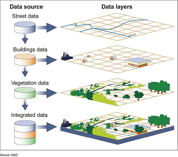
Spatial analysis have become increasingly important in development projects due to their ability to transform geographic data into visual representations. With Geo-spatial analysis we aim at defining a set of methodologies, tools and data through which it is possible to offer a cartographic representation of spatial phenomena, and to perform statistical analysis onto data having a known geographic and spatial extent.
The analysis are performed using software that can process large quantities of spatial and geo-referenced data collected in the field or from GIS, Geographic Information Systems (Geographic Information Systems), Geomatics or satellite images. The graphic and visual elaboration of the process can take place in many ways: through graphs, tables but more interestingly in maps on which it is possible to show geographic phenomena both in their temporal and spatial evolution.


